
Access type
Public state-park trail. No trail reservation or hiking permit is published for this self-guided route. Every vehicle entering the park requires a Georgia State Park Pass; use the official page for the current pass terms.
Check-in or trailhead
418 Amicalola Falls State Park Road, Dawsonville, GA 30534
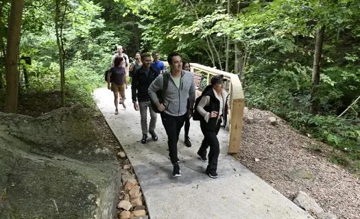
Drive to the West Ridge Falls Access parking area rather than beginning at the Visitor Center. The current park map marks a 0.3-mile paved, accessible route to a middle view of the falls.
Season & current access
The park publishes year-round access during daylight hours. Weather, maintenance and park notices can still affect an individual trail or staircase.
Age, skill & route requirements
The current map marks the 0.3-mile West Ridge Falls Access route as paved and ADA accessible. This profile does not describe the separate 425-step descent, the East Ridge Trail or the 8.3-mile Appalachian Approach Trail.
A short, paved 0.3-mile access trail to the falls viewpoint. The land manager does not publish a separate difficulty grade for this route on the current map; visitors should still expect mountain weather and potentially wet surfaces.
Fit it into a wine weekend
Use the short falls walk as a morning stop, then leave time for lunch before driving toward Dahlonega wineries. Do not turn this accessible route into an unplanned staircase or Approach Trail hike.
Official access or booking details ↗
- Official park hours, pass and current closure notice
- Current official park map and 0.3-mile access route
- Georgia State Parks land-manager page
Reviewed September 30, 2026. Use the official source for day-of access, conditions and availability.